Adding Field to GIS Table
In the previous steps on this tutorial, you have many variables or fields in your map data. Those data include area and population. Now you want to solve this simple challenge: to make Choropleth map of Japan population density . The formula of density is very simple:
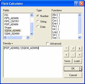
Density = Population / Administrative Area
How to Calculate Density from Population and Area in ArcGIS?
Before that answering that, you need to know how to add field of a table. There are two ways to add a field in your table:
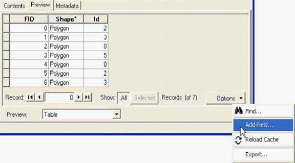
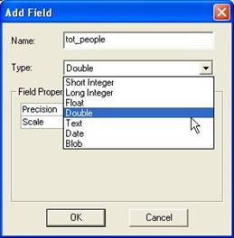
- Using ArcCatalog, click Preview Tab > Table > click Options > click Add Field in the popup menu. Then put the name of the field and type of variable
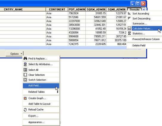
2. Similarly, you can use ArcMap : click the layer > then right click to get the menu, click Open Attribute Table. Table will appear and click Options then Add Field
Now you know how to add a field in your table. The next step is to fill this field with your calculated values. Here is step by step:
- Layer > Open Attribute Table > Option > add field Density ([In ArcMap, Start Edit session)
- Right click on the new field > Calculate Value
- In Field Calculator: use Density = Pop_Admin/sq_Km
To make the Choropleth map , you can refer back the previous step of this tutorial.
This tutorial is copyrighted .
Preferable reference for this tutorial is
Teknomo, Kardi (2015) Introduction to GIS. https:\\people.revoledu.com\kardi\ tutorial\GIS\