What is Buffer and How to Create it?
Buffer or dilation is an area covering a feature (point, line, or polygon) up to some distance. Buffer operation is very important to determine area of influence of the feature. Buffer will create a circular region around a point or a corridor around a line and wider region around a polygon. Buffer transformation in GIS has many applications, for example:
- Setting a centerline of the road and setting buffer equivalent to width of the road may give the full road width. This operation is also useful to determine the required land acquisition of road widening.
- If you set your retail store as a point in the map and setting several ring buffers (say 1 km, 5 km and 10 km), you may distinguish your potential customer by distance.
- Buffering of fire station and hydrant on the map gives potential service of current situation. When two buffers of hydrant actually overlap, in that area, the two hydrants can be used in case of fire. If some area on the map is not included in any fire service buffer, this area is potentially vulnerable to fire hazard. The distance of buffer can be set based on the time for a fire truck to reach that place within a few minute after the call.
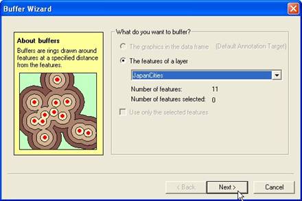
ArcGIS has special wizard to make buffer. For our tutorial, we will make buffer for cities of Japan cities. You use menu Tools Buffer wizard in ArcMap. Follow the wizard as shown below
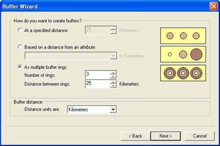
Make buffer 25, 50 and 75 km from city, thus set as multiple buffer rings. You may explore the result of other options as well.
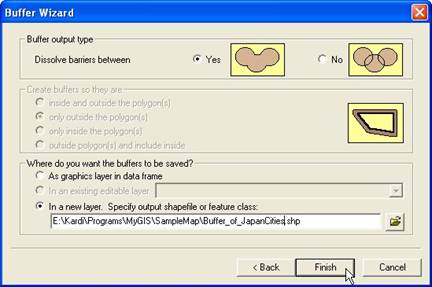
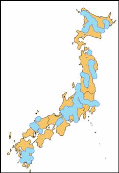
The file name and folder, of course, should be change according to the folder name and file name in your computer. The result is show in the next map.

Practice: Try to make buffer 25 km for Japan Rivers. The result is show below
This tutorial is copyrighted .
Preferable reference for this tutorial is
Teknomo, Kardi (2015) Introduction to GIS. https:\\people.revoledu.com\kardi\ tutorial\GIS\