ArcMap
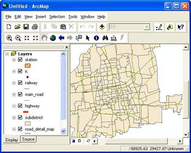
This section of GIS tutorial introduces ArcMap. ArcMap is part of ArcGIS that is used for creating, viewing, querying, and editing maps.
When you load a map in ArcMap, the Maps can be separated by Layers, each layer consist of
- Spatial information (the map, where is the location)
- Shape (type, symbol, color)
- Table attributes
You can only open one map
file
at a time, but several layers or dataset can be added into layers using
![]() toolbar. Each layer can be turn On or Off by clicking the check box on the Layer contents on the left.
toolbar. Each layer can be turn On or Off by clicking the check box on the Layer contents on the left.
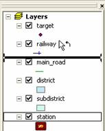
You can easily change the arrangement of the layers by selecting the layer, then do drag and drop to other places. Top layer have better visibility than bottom layers.
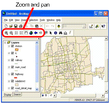
You can explore the map using Tool toolbar to zoom, pan and change the scaling. Try these tools on the map to see how the effects are.
You may select some features using
select feature
![]() tool. Use SHIFT to select more than one feature. Selected features have thicker line.
tool. Use SHIFT to select more than one feature. Selected features have thicker line.
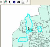
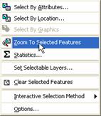
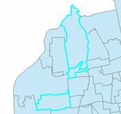
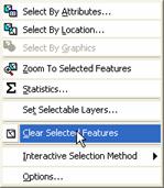
You may choose menu Selection Zoom to Selected Features to see your selection features.
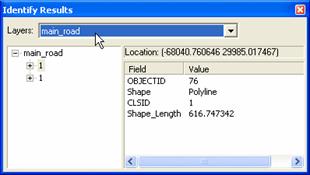
Using this tool
![]() you may identify the result of your features
you may identify the result of your features
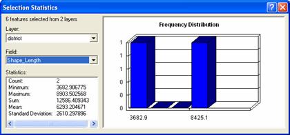
You can also get some statistics on the selected features: Selection - Statistics. Set the layer and field, then you will get the statistics and frequency distribution
Finally, to remove the selection, use menu Selection- Clear Selected Selection
You can measure distance directly on the map using measure toolbar. For example, you want to know what is the distance from fire station your new building you may click you building as starting point and click the fire station nearby. The distance is in the status bar on the bottom.

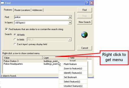
Using Find toolbar, you can directly type the feature, route or addresses that you want to locate. For example, you need to find police station, then you can type �police� and you can get the result (provided that your map contain that features).
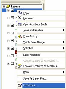
When you do a right click on the layer, a popup menu will come out and open the attribute table of that layer, do something to some selection or change the properties of that layer.
This tutorial is copyrighted .
Preferable reference for this tutorial is
Teknomo, Kardi (2015) Introduction to GIS. https:\\people.revoledu.com\kardi\ tutorial\GIS\