Creating New Map
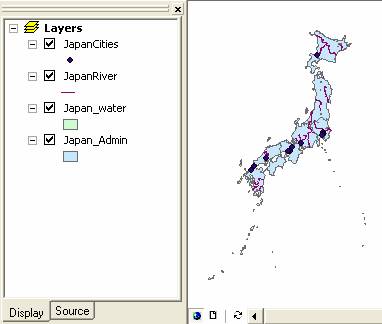
We are going to make a new map, which contain only the extracted map that we have done previously . I assumed you have done the previous section of this tutorial to create layer or shape file of Administrative boundary , Cities , River and Water Features of Japan , extracted from the SouthEastAsia map.
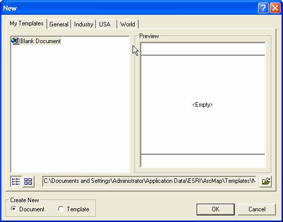
In ArcMap menu click File > New . If it asked to save the previous documents, you can click No.
In the New dialog, select Blank document and click OK button
Use toolbar +
![]() to add new layer. You may add all the extracted layer file or shape file into the map
to add new layer. You may add all the extracted layer file or shape file into the map
Save as new map file
This tutorial is copyrighted .
Preferable reference for this tutorial is
Teknomo, Kardi (2015) Introduction to GIS. https:\\people.revoledu.com\kardi\ tutorial\GIS\